Site Setting Out Survey | Field Setting Out | Surveying Layout


The method of setting out is the reverse of the surveying process. The process involves the positions and levels of building lines and road alignments shown on the construction plans to be established on the ground by various techniques and instruments.
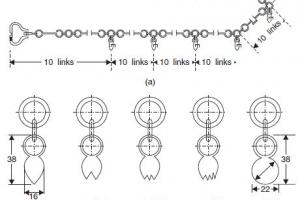
In the field of civil engineering, accurate surveying and setting out is essential for the successful execution of construction projects. Setting out involves transferring the dimensions and locations from engineering designs and plans to the actual site. This process ensures that the construction aligns with the intended specifications and helps maintain precision throughout the project. Several methods are employed in setting out surveys, each suited to different types of projects and terrain. Here, we will discuss some common methods of setting out surveys used in civil engineering, focusing on surveying and leveling techniques.
See Also: Setting Out Circular Curves
Methods of Setting Out Survey
- Setting out buildings by coordinates
- Setting out with theodolite and level
- Checking verticality
- Setting out and alignment in steel-framed buildings
- Alignment and verticality in formwork
- Control and calculation for route surveying

1. Chain and Tape Method:
The chain and tape method is one of the oldest and simplest techniques for setting out surveys. It involves measuring distances using a chain or tape measure and establishing right angles using the 3-4-5 triangle method. This method is suitable for smaller projects with relatively simple geometries, such as boundary demarcations and small building layouts.
2. Total Station Method:
Total station surveying is a modern technique that combines electronic theodolites and electronic distance measurement (EDM) instruments. It enables accurate measurements of angles and distances, along with the ability to record data electronically. With the total station method, surveyors can quickly establish reference points, measure distances, and set out precise coordinates on the site. This method is commonly used in building construction, road alignments, and infrastructure projects.
3. GPS/GNSS Method:
Global Positioning System (GPS) or Global Navigation Satellite System (GNSS) technology is widely used in setting out surveys. GPS receivers receive signals from multiple satellites to determine accurate positions on the Earth's surface. This method allows surveyors to establish control points, measure distances, and calculate coordinates with high accuracy over large areas. The GPS/GNSS method is particularly beneficial for projects that involve vast terrains or require rapid data collection.
4. Optical Leveling:
Optical leveling is employed to establish vertical control on construction sites. It utilizes a leveling instrument, such as a dumpy level or an automatic level, along with a leveling staff. Surveyors measure the difference in height between reference points, known as benchmarks, using the principle of line of sight. Optical leveling is crucial for setting out structures with specific elevation requirements, such as roads, pipelines, and buildings.
5. Laser Scanning:
Laser scanning, also known as LiDAR (Light Detection and Ranging), is an advanced method used for detailed and comprehensive surveys. It involves emitting laser pulses and measuring the time it takes for the reflected light to return. By capturing millions of data points, laser scanners create highly accurate 3D models of existing structures and terrain. Laser scanning is beneficial for complex projects that require precise as-built measurements, such as industrial plants, historical sites, and large-scale infrastructure developments.
It's important to note that the choice of setting out method depends on various factors, including project size, complexity, accuracy requirements, and available resources. A skilled surveyor will assess these factors and select the most appropriate method for each project. Accurate setting out surveys are crucial for ensuring that construction aligns with design intent, minimizing errors, and optimizing project efficiency. By employing the right techniques, civil engineers can achieve precise and successful project execution.
Setting out Survey works also include
 Computations and setting out Methods for:
- Simple Circular Curves
- Compound Curves
- Reverse curves
- Transition curves
- Vertical curves
- Setting out of horizontal alignment
- Setting out of vertical alignment
- Setting out of cross-sections
- Setting out of bends
Setting Out Tools and Equipment
- Pegs
- Tape measure/measuring wire
- Ranging rods
- Triangle sets
- Cross staff
- Optical square
- Gradient template
- Straight-edge in combination with spirit level
- Dumpy level
- Water manometer
- Tube water level
- Camberboard