Skip to main content
5 Travel Myths You Need to Stop Believing Right Now
Canal Comes Alive with Lighted Boat Parade.
Scope of GIS Project Management & Planning
Scoping GIS projects
- Project versus System implementation
- Tomlinson is a book written for system implementation, but is useful for project implementation
- 10 stage GIS planning methodology,
Single-purpose GIS project
- Initiated to serve one-time objectives
Departmental GIS project
- A department is responsible for implementing GIS functionalities
Enterprise GIS project
- Many functions are shared between different department, thus implementing GIS projects across multiple departments make sense (MPLIS chapter 16 describes the Enterprise GIS project)
- Will benefit from system integration
- Increasing strategic roles of GIS in an organization
Societal GIS project
- Cost sharing by the society as a whole
Methodology for GIS project implementation – the core
Needs assessment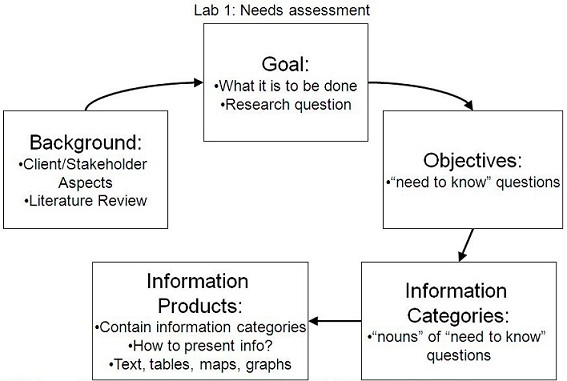
- Data needs
- Functional needs
- Processing needs
System requirement
- Hardware/software needs
- Personnel/training needs
- Procedural needs
- Institutional needs
Data needs
- Geographic information needs inventory (Huxhold Figure 16-3)
- Identifies which maps or data are important for successful completion of each function in the unit
- Describe problems of current data and point out future needs as well
- Map inventory form will help you clarify issues involved in map use (Huxhold Figure 16-5)
Functional needs
 Identify activities which an organization perform to carry out its mission
- Identify all of their organizational units
- List the functions that require maps or other geographic information (Huxhold Figure 16-2 list of functions requiring geographic information by dept & function)
Processing needs
- Define how the data are to be used to fulfill the functional needs of the organization
- Application definition form contains data input requirements, processing requirements, and output products (Huxhold Figure 16-9)
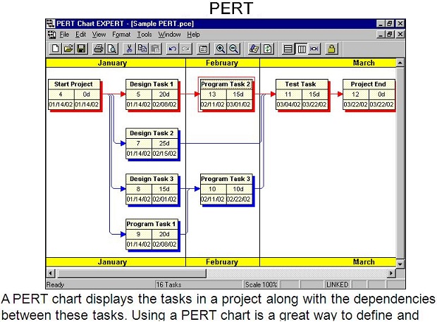
Project management
- Project Management Job Functions
- Management tools
- WBS (Work Breakdown Structure) chart
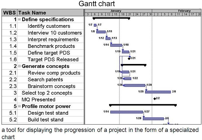 Gantt chart
- PERT (Program Evaluation and Review Technique)
Needs assessment
- Lab 1 activity
- Arrange the meeting for needs assessment
Needs Assessment Meeting Objectives
 learn about the client’s organization
- determine who are the stakeholders/users
- help the client to understand the capabilities of GIS
- determine what the client’s goals or what they “need to know”
- begin to identify background resources and data sources
Related Civil-Engg. Content